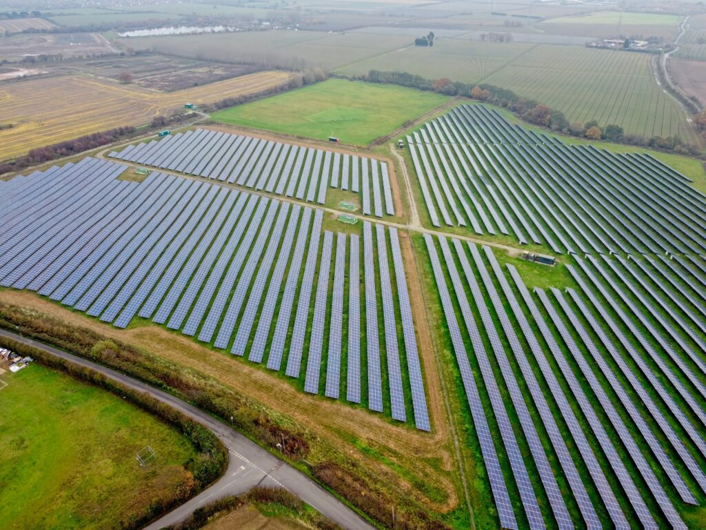
Renewable Energy Drainage Services in Kentucky

Dewatering, Tile Work, and Erosion Control for Utility-Scale Solar on Kentucky Farm Ground

Kentucky Is Building Solar on Ground That Already Fights Water

Kentucky has roughly 1,226 MW of utility-scale solar operating across 20 farms, and thousands more megawatts moving through the interconnection queue behind it. Most of the built capacity sits on farm ground in the western half of the state, where water has been the limiting factor on row-crop yield for decades.

Abraham Drainage & Excavating is a veteran-led drainage contractor serving EPC firms, solar developers, and engineering teams building utility-scale solar in Kentucky. Kentucky work runs through the same renewable energy drainage practice we operate across the Midwest. We find the tile before the pile driver does, hold the ground stable through construction, and hand over records that satisfy the Division of Water, the Siting Board, and the landowner whose field is next door.

Straight answer on our footprint: our built work is in Ohio, Indiana, Illinois, Michigan, New York, and Wisconsin. Kentucky is a market we are entering, and we would rather say that than let a page imply otherwise. What transfers is the ground. The Ohio River bottoms that run through Henderson and Union Counties are the same alluvial system our Indiana crews work across the river, and the tile in them was installed by the same generation of farmers for the same reason.

What Goes Wrong When Kentucky Ground Is Read Wrong

Kentucky is not one drainage problem. It is five, and a single developer portfolio can hit all five in one construction season.

The Ohio Valley counties in the Western Coal Field are bottomland: wide, flat, poorly drained ground carrying the state’s most active row-crop tile installation. The Jackson Purchase in the far west sits on loess over coastal plain sediment, where a fragipan holds a seasonal water table close to the surface. The Pennyroyal across south central Kentucky is karst, with sinkholes, caves, and subsurface channels, and the Mammoth Cave system inside it. The Bluegrass runs limestone and shale under rolling ground with sinking streams and springs. Eastern Kentucky is converting reclaimed surface mine land, where compacted spoil and engineered benches void every infiltration assumption carried over from a farm site. Grading logic that works in Henderson County will fail in Barren County and fail differently in Graves County.

On former farm ground in Kentucky, utility-scale solar sites frequently run into:

Legacy subsurface tile in the Ohio Valley counties, installed by farmers over decades, rarely mapped, and easily severed by pile driving or trenching
Karst in the Pennyroyal and Bluegrass, where sinkholes and open conduits carry surface water straight into groundwater with no filtration between
Perched water tables over fragipan in the Jackson Purchase that hold water at the surface long after the rain stops
Compacted spoil and engineered benches on reclaimed mine ground in the east, which drain nothing like the native soil the design assumed
Spring rainfall landing in the same window crews need for grading, trenching, and pile driving

What that costs when it is missed:

Sediment leaving the site through a sinkhole and into an aquifer, which turns an erosion control problem into a groundwater problem
Water standing under arrays and against inverter and transformer pads, accelerating corrosion and shortening component life
Failed erosion control inspections, stop-work exposure, and enforcement from the Division of Water
Claims from neighboring landowners after tile is cut, an outlet is blocked, or water is rerouted onto productive ground
Access roads that fail under load in spring, stalling construction traffic and O&M access on the same alignment
Wisconsin utility-scale renewable energy drainage contractor

Five Kinds of Ground, One Construction Season

Most drainage contractors are calibrated to one kind of ground. Kentucky does not allow that. Bottomland tile, karst conduit, perched loess, Bluegrass limestone, and reclaimed mine spoil each fail for a different reason and each need a different fix.

We plan for the ground in front of us and price the difference honestly. On a Kentucky project that means:

Dewatering sized to the site, whether the ground holds a legacy tile network or has never carried a line of pipe
Tile investigation before disturbance, so the first crew to find an undocumented line is ours and not the pile driving crew
GPS tile mapping and closeout documentation built to feed Siting Board filings, KYR10 compliance files, county records, and landowner obligations
Laser-guided grading set to the region we are standing in: Ohio Valley bottomland, karst plateau, loess flatland, Bluegrass rolling ground, or reclaimed bench
Tile installation, tie-ins, and repair that protects working outlets and keeps the surrounding farmland productive

That work is backed by 15.8 million feet of pipe installed across the Midwest, 291 completed projects, and more than 26,100 acres evaluated for drainage risk. Kentucky projects draw on that record from day one.

Water doesn’t wait. Your drainage plan needs to be ahead of it.

What We Build on Kentucky Solar Sites

Reading the Site Before the First Cut

A wet site does not need a history of drain tile to need dewatering. Perched water over fragipan in the Purchase, a high seasonal table in the river bottoms, and compaction on reclaimed benches all produce the same problem: crews cannot work the ground after it rains. We build the system that gets the site back to workable.

• Wellpoint and sump dewatering sized to the water the site is actually holding
• Temporary discharge routing, filtration, and outlet protection during construction
• Perched water interception where a dense subsoil layer is doing the damage
• Pad, trench, and foundation dewatering through the pile driving and electrical sequence
• Permanent subsurface systems where the site needs to stay dry after turnover

Tile Work: Installation, Tie-Ins, and Repair

Subsurface drainage keeps pads, roads, inverter areas, and work zones usable through construction and operation. In the Ohio Valley counties especially, new work ties into row-crop drainage systems that are decades old, partly documented, and still serving productive ground next door.

• Subsurface drain tile from 4 in. to 24 in.
• Trenching for drainage runs, conduit corridors, and shared utility alignments
• Outlet work and connections into receiving systems that can take the flow
• Main line repair, culvert tie-ins, and pipe fusion
• GPS as-builts written for county files, project records, and landowner handover

Erosion Control Built for KYR10 and for Karst

Kentucky construction stormwater runs under the KPDES KYR10 general permit, administered by the Kentucky Division of Water, for any site disturbing one acre or more. Where karst is present the stakes climb, because surface water can reach groundwater in hours with no soil filtration in between. We install controls that hold up between inspections rather than the minimum that passes one.

• Riprap, check dams, and geotextile stabilization on grade
• Bioswales, vegetated conveyance, and flow control features
• Silt fence, wattles, and inlet protection built to the SWPPP as written
• Retention and detention features sized to the site
• Sinkhole buffer treatment and diversion away from open karst features
• Inspection record support on the KYR10 schedule, including the post-rainfall entries

Haul Roads That Hold Through a Kentucky Spring

Saturated shoulders and spring rain put road sections under load at the worst possible time. We build drainage into the road rather than beside it, so construction traffic and O&M vehicles keep moving.

• Cross-drains and culverts at crossings and low points
• Crown correction and shoulder shaping for sustained load
• Roadside swales, outlets, and rock chute stabilization
• Aggregate base built for all-weather access, not fair-weather access
• Access windows planned around the western Kentucky spring rainfall pattern, not around an average year

Keeping Water Off the Racking and Pads

Standing water inside the array is an asset problem that surfaces years after turnover. Corroded pad steel, warranty exposure, and O&M trucks that cannot reach a string in April all start the same way. We target the zones that hold it.

• Drainage at inverter and transformer pads
• Aggregate trenching and underdrain work through racking areas
• Underdrain sizing set for perched water over fragipan where the Purchase soils call for it
• Runoff management at panel drip lines and slope transitions
• Drainage designed around pollinator and agrivoltaic ground cover plans

Farm Ground Protection and Tile Repair

Kentucky utility-scale solar lands on working farm ground, and the obligations that come with it are written into leases, easements, and county conditions. We execute the drainage half of those commitments and document them for the project file.

• Tile located and verified against county drainage records before easement work begins
• Drain tile repair inside gen-tie and transmission easements
• Topsoil segregation, replacement, and decompaction on disturbed agricultural ground
• Restoration of disturbed slopes, waterways, and field outlets
• Landowner-facing records of tile located, cut, repaired, and verified

Here is how we plug into a Kentucky EPC package as a subcontractor to the general or civil contractor, with the documentation trail procurement teams expect.

Why Choose Us

Why Kentucky Project Teams Bring Us In

Air Force Discipline, Applied to Dirt
Our leadership came up in the U.S. Air Force. In the Air Force a thing was either ready or it was not, and nobody graded on effort. Same standard here. We show up ready, we say what we found, and we do not build shortcuts into work that gets buried.
We Do Not Hold Up Energization
Energization dates are not suggestions. We organize crews and equipment to plug into an active construction sequence, absorb field changes, and keep drainage off the critical path.
Status You Do Not Have to Ask For
Project teams get a written drainage status covering what we found, what changed, and what it costs. On a Kentucky site that means an undocumented line gets reported the day it is cut, not at the end of the month.
We Already Work This River
Our Ohio base and our Indiana and Illinois work put us on the same river system and the same soil families that run through western Kentucky. The Ohio River bottoms do not stop at the state line, and neither does the tile.
Closeout Packages Built for Review
We track Kentucky’s requirements as they move: KYR10 construction coverage and inspection records, Siting Board conditions under KRS 278.700 through 278.716, county planning and zoning conditions, and landowner tile commitments. The result is a closeout package that answers questions instead of raising them.

Five Corridors, Five Different Drainage Problems

Kentucky’s utility-scale solar activity concentrates in five build corridors, and each one sets its own drainage priority.

Western Coal Field and Ohio Valley (Henderson, Union, Webster, Daviess Counties):

The center of gravity for Kentucky solar. Sebree Solar covers roughly 2,100 acres in Henderson County across two phases, with Phase I online at 250 MW since September 2025 and Phase II adding 150 MW. Unbridled Solar operates 160 MW across Henderson and Webster Counties. This is wide, flat, poorly drained ground with the state’s most active row-crop tile installation. Legacy tile density and outlet protection drive site planning here, and undocumented lines are the single largest change-order risk on these sites.

Jackson Purchase (Ballard, Graves, McCracken, Hickman Counties):

Kentucky’s far western tip, and an active part of the development pipeline. Gage Solar is planned at roughly 240 MW in Ballard County. Mayfield Solar and Storage is planned at 200 MW across roughly 1,869 acres in Graves County. The ground is loess over coastal plain sediment: flat, silty, and prone to perching water above a fragipan. Standing water shows up here without a shallow water table to explain it. Surface grading and underdrain work carry more weight than deep tile.

Pennyroyal and Karst Country (Logan, Todd, Barren, Metcalfe, Lyon, Meade Counties):

SR Russellville carries 173 MW in Logan County. Glover Creek Solar operates 55 MW in Metcalfe County and Ashwood Solar I 86 MW in Lyon County. Green River Solar puts 200 MW on the ground across Breckinridge and Meade Counties, where the karst plain runs north to the Ohio River. This is Mississippian limestone with sinkholes, caves, and subsurface channels under it. Standing water is rarely the problem. Sediment leaving the site through an open karst feature and into groundwater is. Erosion control here is a groundwater protection scope, not a checklist item.

Bluegrass (Harrison, Mason, Garrard, Bourbon Counties):

Bluebird Solar operates 100 MW in Harrison County and SR Turkey Creek 50 MW in Garrard County. Goldfinch Solar is in development at up to 250 MW in Mason County. Limestone and shale under rolling ground, with sinking streams and springs. Grade control and outlet placement matter more here than tile volume. Garrard County also reaches into the Knobs, where shallow bedrock changes what trenching costs before the first machine moves.

Eastern Coal Field Reclaimed Mine Ground (Martin, Perry, Knott, Breathitt Counties):

Martin County Solar put 111 MW on 850 acres of the former Martiki mine and reached commercial operation around the turn of 2024 into 2025. The Starfire project is planned at 410 MW across Perry, Knott, and Breathitt Counties in four phases, with the first phase approved for construction in 2025. Compacted spoil, engineered benches, and rebuilt drainage patterns behave nothing like native soil. Infiltration assumptions carried over from a farm site will not hold. We price that ground on its own terms.

Kentucky does not sit alone in our footprint. Cross the river from Henderson County and our Indiana solar drainage work is standing on the same alluvium and the same generation of tile. Farther west, our Illinois solar drainage projects sit on the loess and bottomland that continue into the Jackson Purchase.

The Kentucky Regulatory Stack, in Plain Terms

Four separate authorities touch drainage on a Kentucky solar project. They do not coordinate with each other, and clearing one does not excuse the others.

Kentucky Renewable Energy Drainage

Siting, at the State Board on Electric Generation and Transmission Siting.

Under KRS 278.700 through 278.716, a merchant electric generating facility with an aggregate capacity of 10 MW or more must obtain a construction certificate from the Siting Board before construction begins. Utility-owned generation follows a separate PSC certificate path instead, and projects under 10 MW answer to local zoning alone.

House Bill 4, effective June 28, 2023, changed the terms. Certificate validity moved from two years to three. A decommissioning plan and bond became mandatory application elements rather than conditional add-ons. The bond is set by an independent licensed engineer on the net present value of decommissioning cost less salvage value, or the amount a local ordinance requires, whichever is greater, and the Cabinet reviews it at least every five years. Local planning and zoning commissions hold primacy on setbacks and on decommissioning, and the Siting Board cannot waive what a local commission sets. On a Kentucky site the county is not a formality.

Stormwater, at the Kentucky Division of Water.

The KPDES KYR10 general permit covers land-disturbing construction of one acre or more, including contiguous activity inside a larger common plan of development that cumulatively disturbs one acre or more. The Notice of Intent goes in at least seven days before construction starts, and authorization is effective only when the Division of Water issues written notification of coverage. Filing is not coverage. The SWPPP has to be developed specific to the site. Inspections run at least once every seven calendar days, or at least once every fourteen calendar days paired with an inspection within 24 hours of any storm event of 0.5 inch or greater. Records are retained at least three years from termination of coverage or expiration of the permit.

Farm ground, at the county conservation district.

The Kentucky Agriculture Water Quality Act, KRS 224.71-100 through 224.71-140, requires landowners with 10 or more contiguous acres in agriculture or silviculture to develop and carry out an Agriculture Water Quality Plan built on statewide best management practices. The Division of Conservation administers it and local conservation districts provide the technical assistance. Where solar lands on leased farm ground, the landowner’s plan does not disappear. Separately, drainage districts organized under KRS Chapter 267 and county ditches under KRS Chapter 269 carry their own board approvals and outlet rights. Under KRS 267.450, a landowner assessed for the cost of a drainage improvement may use that improvement as an outlet for lateral drains. Where a project touches one, that gets identified before design is locked.

Groundwater, where karst is present.

401 KAR 5:037 requires groundwater protection plans for a defined list of activities, including bulk fuel and chemical storage and handling and the installation or abandonment of wells and bore holes. Several of those land on a solar construction site even though land-disturbing construction itself is not on the list. In karst terrain that matters more than the regulation’s narrow scope suggests, because a sinkhole is a direct route from the surface to an aquifer with no soil in between.

What that means in practice on a Kentucky site:

GPS capture of existing tile, outlets, and any organized drainage district or county ditch in and adjacent to the project area, completed before disturbance.

Sinkhole and closed depression mapping where the site sits in karst terrain, with buffers and diversions designed in rather than added after a failure.

KYR10 Notice of Intent submitted at least seven days ahead, with written coverage in hand before soil is disturbed, and a SWPPP written to the actual site instead of a regional average.

Inspection records on the KYR10 schedule, including entries within 24 hours of a 0.5 inch rainfall, retained three years past termination of coverage.

Siting Board conditions and county planning commission conditions tracked as two separate obligations, because they are.

Decommissioning documentation that accounts for restoring drainage function and tile integrity, not just panel removal.

Landowner tile repair inside gen-tie and transmission easements, documented and verified
Coordination with the county conservation district where an Agriculture Water Quality Plan is in force on the host ground.

We meet those expectations by pairing field execution with drainage work we have already closed out on utility-scale solar sites in six states.

How a Kentucky Job Runs

01

Site Walk and Region Check

We walk the site with your project management or civil team to locate known drainage features and confirm which Kentucky region we are working in. That means checking for organized drainage districts and county ditches, mapping sinkholes and closed depressions where karst is in play, and interviewing landowners about tile nobody wrote down. Findings are GPS-documented and handed back before they become field surprises.

02

Scope, Price, and Named Risk

You receive a detailed proposal covering scope, pricing, materials, and schedule. We name where change-order risk actually sits on your site: undocumented tile density in the Ohio Valley counties, karst voids and shallow bedrock in the Pennyroyal, perched water over fragipan in the Purchase, or compacted spoil on reclaimed mine ground. If a drainage district or conservation district approval is needed, we identify it here and say who files it.

03

Field Execution and Daily Records

Our crews work alongside your construction team and respond to tile encounters the day they happen. We document work with GPS coordinates and photography as it goes, and we support the KYR10 inspection record, including the entries triggered within 24 hours of a half-inch rainfall.

04

Closeout Package Handover

Before turnover we verify drainage performance and assemble the package: GPS tile maps showing line locations and repair points, erosion control and SWPPP documentation in the form KYR10 requires, records supporting Siting Board and county conditions, and the landowner record for every line we touched, with locations and repair verification.

05

Support Through Later Phases

Phases get added and conditions change. We stay reachable through construction and mobilize for scope additions, added controls, or drainage that a later phase turns into a problem.

Building in Kentucky under an EPC?

We subcontract to EPC teams on utility-scale solar across Kentucky. Drainage design, dewatering, tile relocation, and civil sitework, scoped to your drawings and your schedule.

Kentucky Drainage Questions We Get From EPC Teams

Get Kentucky Drainage on the Schedule

Kentucky ground changes five times between Paducah and Pikeville. Get the drainage read before the first pile goes in, not after.

Or Call Us now at